This place snapshot provides a summary of future development in the Mernda area for current and future residents, business owners, investors and community groups.
You can download the full Mernda place snapshot or explore areas of interest on this webpage by clicking the above links.
Download Place Snapshot: Mernda(PDF, 1MB)
For snapshots of development in other areas, see Place snapshots: a guide to development in your area.
Mernda means young girl (derived from murnmurndik) in Woiwurrung the local language of the Wurundjeri people.
Europeans settled in the 1840s and the land was mainly used for dairy farming.
Early industry included a unique concentration of flour mills along the Plenty River.
The post office opened in 1875 and parts of the original school, Methodist church, bakery/store, hotel, railway station and Mechanics’ Institute still stand.
In the early 1900s there were many dairy farms in Mernda that supplied milk to Melbourne.
Overview
By 2036 it is estimated that the population of Mernda will increase by about 68% from 16,800 (in 2015) to an estimated 28,200, with an increase in the median age over the same period from 29 to 35.
By 2036 the largest age groups are expected to be 35 to 49 year-olds followed by 50 to 59 year-olds.
Mernda has the third largest Aboriginal and Torres Strait Islander population in the municipality, behind Whittlesea Township and Epping.
Births
In 2015, there will be an estimated 403 births (eight per week on average) and by 2036 this is expected to increase 472 births per year (nine births per week on average).
Diversity
The most common languages spoken other than English are Italian, Macedonian and Greek and the most common country-of-birth other than Australia include England, India and Italy.
Overview
By 2036 the number of dwellings will increase from about 6,200 to 10,500. 39% of those households will be couples with children, down from the 2015 figure of 44%.
Employment
In 2015 the most common types of occupation are:
- professionals: 18%
- technicians and trades workers: 18%.
More residents work in the construction industry compared with any other industry.
Education
In 2015, 3% of residents are attending preschool and 10% are attending primary school.
Car use
In 2015, 72% of dwellings have access to two or more motor vehicles and 73% of residents drive a car to their place of work.
Located 30 kilometres north-east of Melbourne’s city centre, Mernda is a rapidly developing residential area of around 17km2.
As of 2015, it is one of the fastest growing areas in Australia.
When fully developed, Mernda will accommodate over 30,000 square metres of retail space for supermarkets and shops.
An additional 80,000 square metres will be for commercial use for:
- offices
- small businesses
- medical facilities
- gym
- child care.
Mernda Strategy Plan
Our Mernda Strategy Plan 2004 (amended in 2008) provides the planning and design framework for development of the Mernda and Doreen growth area.
View the Mernda Strategy Plan
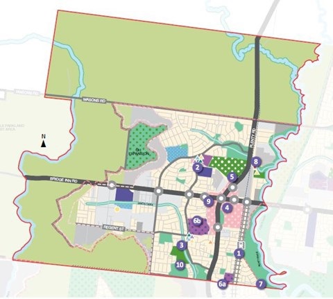
Mernda development plans
These plans show the proposed development for a number of new housing estates within Mernda. Development of these estates will generally follow the plans but is subject to change. Some of these plans are only extracts from the full development plans.
To request a complete plan with related policy content, or if you are unable to access the information in these documents, please
call (03) 9217 2346.
-
Everton Gardens Development Plan
-
Heals Road Development Plan
-
Mayfield Groves - Plenty Road development plan
-
Mayfield Historic Precinct Development Plan
-
Mernda Town Centre South West Development Plan
-
Mernda Town Centre North (North) West Development Plan
-
Mernda Town Centre North West Precinct Development Plan 2012
-
Mernda Villages Development Plan
-
Mernda West Development Plan
-
Renaissance Rise Development Plan
-
Riverdale On Plenty Development Plan
-
Park Hill Estate Development Plan Approved May 2016
-
Woodland Waters Development Plan
-
Fairview Estate Development Plan
-
Mernda On The Park Development Plan
-
Mernda Town Centre North East Development Plan Approved Aug 16
-
Mernda Town Centre Development Plan Approved Amended Nov 2018
See the location of these new developments on our interactive map
- Rail Extension to Mernda: In 2018 the State Labor Government opened the Mernda Rail Extension.
- Mernda Village Community Centre
- Jindi Family And Community Centre
- Future Mernda Town Centre
- Mernda Regional Recreation Reserve
- Mernda schools:
- Mernda Park Primary School, Riverdale on Plenty Estate: Opened in January 2017. This school site also includes an integrated Council kindergarten, maternal and child health facility and a long day child care centre.
- Mernda Central College: Opened in 2017 to Year 7. The College grew to include Year 12 in 2022.
- Mernda Police Station: Opened in 2018.
- Waterview Recreation Reserve